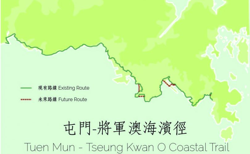
The Tuen Mun – Tseung Kwan O Coastal Trail
We are proud to introduce the Tuen Mun to Tseung Kwan O Coastal Trail. The 60km trail runs as close as possible along the waterfront.
The trail connects Butterfly Beach at Tuen Mun with Lohas Park at Tseung Kwan O. Attractions along the way vary from beaches to promenades, from museums to cafes, from leisurely parks to industrial and harbour areas. Teams have studied the route, documented sights and destinations, and identified opportunities for future enhancement and improvements along the trail.
The trail is subdivided in seven walks. For obvious safety reasons, the Kwai Chung City Walk runs along Lai King Hill Road instead of the Kwai Tsing Container Terminals. Other sections of the trail will improve over time as development proceeds at the former Kai Tak airport and along Cha Kwo Ling. Government is working on a pedestrian connection along the New Yau Ma Tei Typhoon Shelter between Tai Kok Tsui and West Kowloon.
The Tuen Mun to Tseung Kwan O Coastal Trail is the third coastal trail published by Designing Hong Kong and Trailwatch. Trails published earlier include the Hong Kong Island Coastal Trail and the Tsing Yi Coastal Trail. The objective of the coastal trail development program is to promote and connect waterfronts throughout Hong Kong. Waterfronts can be easily enjoyed by people of all ages and offer spectacular views and cooler weather. To learn more about our projects, please visit www.coastaltrail.hk.
Tuen Mun – Tseung Kwan O Coastal Trail – 60km divided over 7 walks:
- The Castle Peak Bay Walk 青山灣段;
- The Ting Kau Beach Walk 汀九段;
- The Kwai Chung City Walk 葵涌段;
- The West Kowloon Coastal Walk 西九龍段;
- The Kowloon Harbour Walk 九龍段;
- The Kai Tak City Walk 啟德段; and
- The Junk Bay Walk 將軍澳段.
The Castle Peak Bay Walk 青山灣段
Starting at Butterfly Beach, the walk first along the promenade at Tuen Mun Pier and some industrial areas in Tuen Mun. After passing the Sam Shing Estate, the coast consists intermittently of beaches and promenades. Next, pass through the Hong Kong Gold Coast and walk along Castle Peak Road. After Tai Lam, you will walk along the promenade all the way to Tsing Lung Tau. You may visit the Tin Hau Temple there then continue your journey to Sham Tseng.

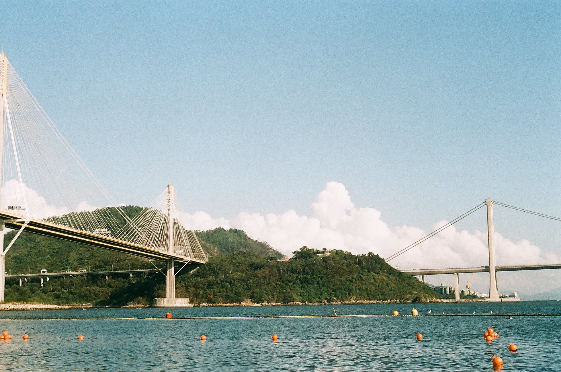
The Ting Kau Beach Walk 汀九段
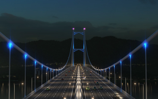
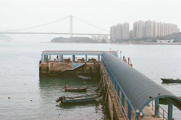
After leaving the town centre of Sham Tseng, it marks the start of another series of beautiful beaches which offer perfect venues for water sports. After passing the popular Lido Beach, Ting Kau Bridge, one of the longest cable-stayed bridges in the world, comes into sight. Walk past the settlement in Ting Kau and you will find yourself in Tsuen Wan. Follow the footpaths and promenades to end the trail at the Tsuen Wan West station.

The Kwai Chung City Walk 葵涌段
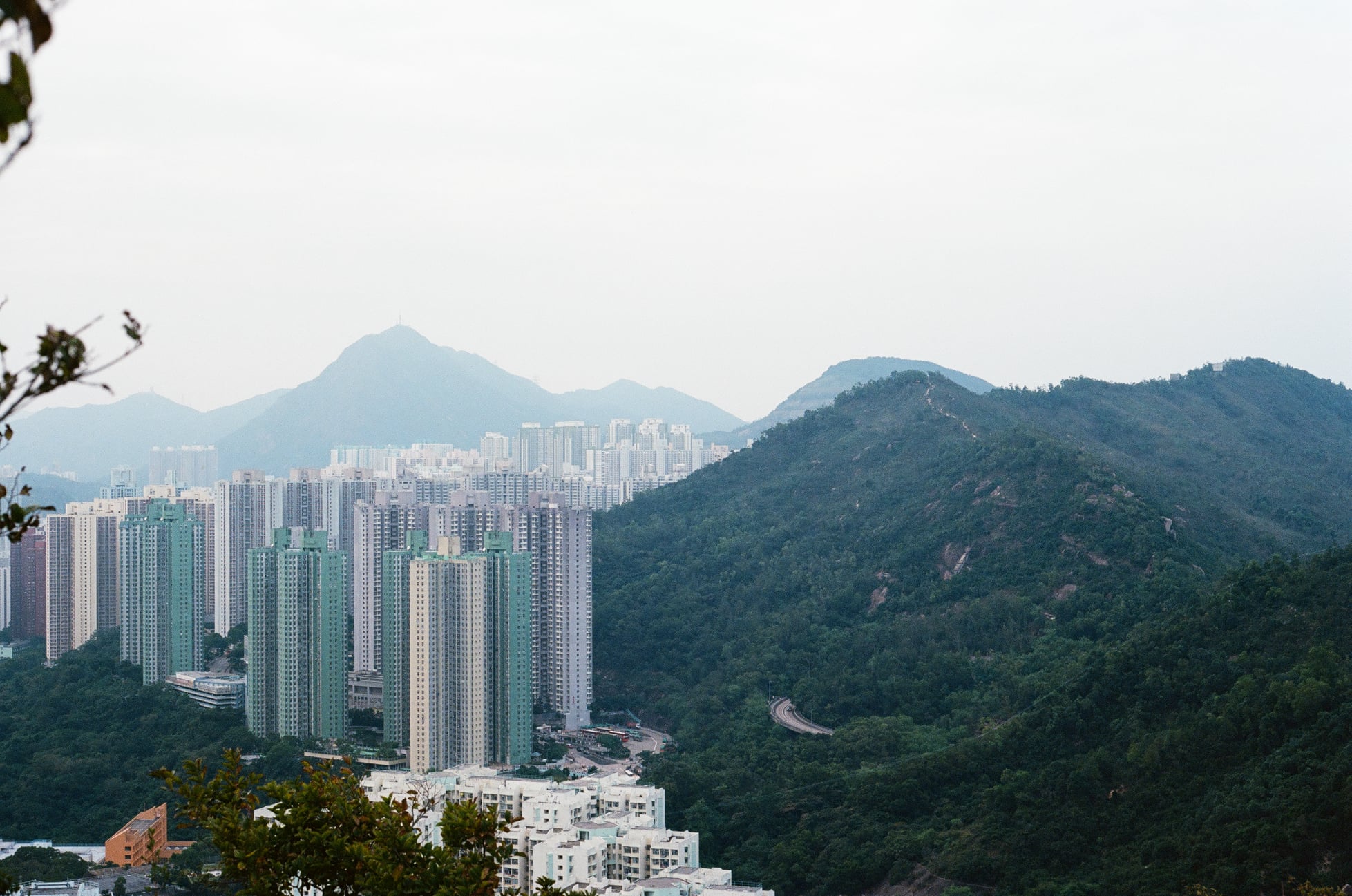
From the Tsuen Wan West Station you can enjoy the different urban parks including the Tsuen Wan Riviera Park. After you pass the Tsuen Wan Slaughterhouse and the Tsuen Wan Chinese Permanent Cemetery, you arrive at the Kwai Chung Park (open in 2024). Kwai Tsing Road will lead you along the main port facilities of Hong Kong, the Kwai Tsing Container Terminals. The route joins Lai King Hill Road via the stairs next to Lai King MTR Station. From there, you walk up to Lai King Hill Road and down to Lai Chi Kok Park. Next you walk along Sham Mong Road to arrive at the pedestrian bridge which brings you to Nam Cheong Station.

The West Kowloon Coastal Walk 西九龍段
From Nam Cheong Station, walk south to start the West Kowloon Coastal Walk. Walk along the Hoi Fai Road Promenade featuring designer chairs. Until the government links Tai Kok Tsui and West Kowloon directly, the route will take you away from the harbour to Olympian City from where you go south to Lin Cheung Road and Hoi Wang Road. Here you turn right back towards the coast and walk to the entrance of the West Kowloon Cultural District. Enjoy the many cultural and eatery facilities with stunning views. Leaving the West Kowloon Cultural District, pass China Hong Kong City and walk along the Gateway Boulevard to reach Harbour City and the Tsim Sha Tsui Star Ferry Pier.

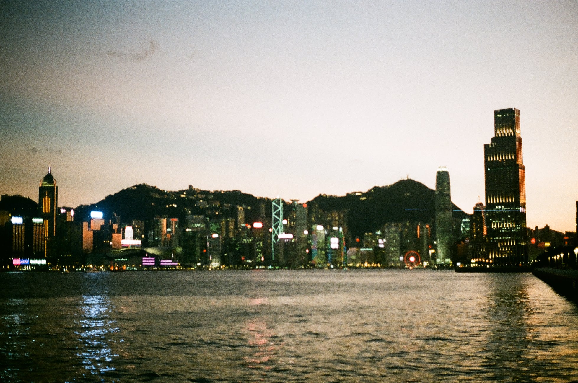
The Kowloon Harbour Walk 九龍段
Kowloon Harbour Walk showcases the grandeur of Hong Kong. From the Tsim Sha Tsui Ferry Pier you can admire the magnificent skyline of Hong Kong. Continue east, you walk past the Hong Kong Cultural Centre, the Hong Kong Museum of Art and the Hong Kong Space Museum. Along the Avenue of Stars you encounter the palm prints of celebrities along the wooden railings and the K11 Musea. Continue along the coast to and up the pedestrian flyover near the Hung Hom Railway Station and Hong Kong Coliseum. The trail joins the Hung Hom Promenade from where you reach the Tai Wai Shan Park, followed by the Hutchison Park and ending at Kowloon City Pier.

The Kai Tak City Walk 啟德段
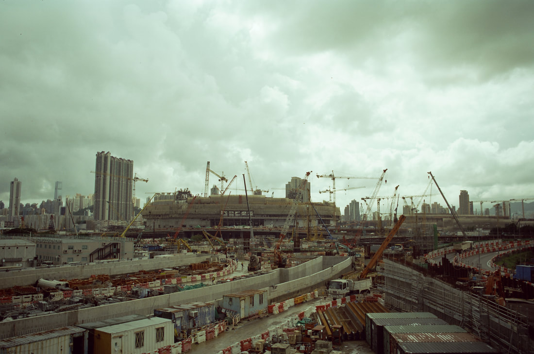
The Kai Tak Walk will continuously change as the works at the former Kai Tak airport and Cha Kwo Ling progresses. Walk from Kowloon City Pier along the shoreline until you reach the Kowloon City Ferry Pier. For now, follow San Ma Tau Street, To Kwa Wan Road, Shing Kai Road and Kai Shing Street to arrive at Kowloon Bay. From the International Trade & Exhibition Centre at Kai Cheung Road go up to the pedestrian bridge and walk along the construction site to find the Kwun Tong Promenade. At the Kwun Tong Preliminary Treatment Works enter Wai Yip Street and walk to Cha Kwo Ling. Here, you can find the Cha Kwo Ling Testicles Rocks and Tin Hau Temple. Continue the walk to Yau Tong Station.

The Junk Bay Walk 將軍澳段
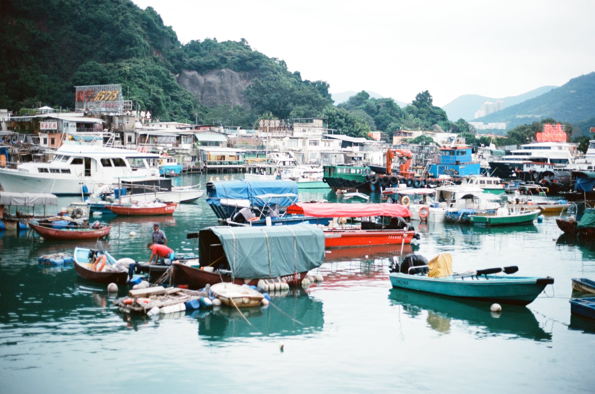
From Yau Tong Station, walk along Ko Fai Road to find clusters of industrial buildings. Turn at Tung Yuen Street and walk until you arrive at the Sam Ka -Tsuen Typhoon Shelter. Walk around the shelter to arrive at Lei Yue Mun for a seafood meal. Walk along the shore of Lei Yue Mun, the light house, the Tin Hau Temple and the former Lei Yue Mun Quarry. Go up the path besides Ma Pui & Che Teng Fresh Water Pumping House to arrive above the Junk Bay Chinese Permanent Cemetery. Go down the hill to arrive at Tiu King Leng and turn into Tong Yin Street to arrive at the Tseung Kwan O Waterfront Park. Walk around the East Channel or take the footbridge to go to Lohas Park where you find the MTR Station.

Comments or and proposals for trails
We welcome your ideas for other coastal trails, and suggestions for improvements along Tuen Mun – Tseung Kwan O Coastal Trail. Send us your comments: [email protected]. Click here to learn more about Tuen Mun – Tseung Kwan O Coastal Trail!
屯門—將軍澳海濱徑
繼港島環島徑及青衣環島徑後,創建香港再次與Trailwatch合作,推出第三條海濱徑。屯門—將軍澳海濱徑(屯將海濱徑)。這條全長60公里的海濱徑連接屯門蝴蝶灣和將軍澳日出康城,沿途會經過海灘、海濱長廊等,更會探索城市中的公園、工業區,當然還有聞名於世的維多利亞港。我們著手研究路線,進行了多次的實地考察,沿途紀錄了不同的景點。
屯將海濱徑共分為七段。為了將市民帶近岸邊,我們規劃的路線均盡可能貼近海傍。但因安全理由,葵涌段的路線將以荔景山道取代葵青貨櫃碼頭旁的行人路。同時,隨啟德發展區和茶果嶺一帶的發展等,海濱徑的其他路段亦會在未來逐漸改善。我們亦正在爭取開通連接大角咀和西九文化區的新油麻地避風塘行人通道。
整個計劃希望可以推廣和連接香港的海濱,讓不同年齡層和能力的人都能輕鬆享受海岸的壯觀景色。想了解更多?歡迎參閱我們的網頁。
屯將海濱徑分為7段:
- 青山灣段
- 汀九段
- 葵涌段
- 西九龍段
- 九龍段
- 啟德段
- 將軍澳段
青山灣段
從蝴蝶灣沙灘開始,先沿屯門碼頭海濱長廊走,再經過屯門一些工業用地,便會到達三聖邨。經過三聖邨後,沿途間斷由海灘和海濱長廊組成。穿過香港黃金海岸後,經過掃管笏,一直沿青山公路步行,你將會到達大欖。再跟著青山公路的海濱行人路走,就會抵達青龍頭。你可以參觀那裡的天后宮,然後再繼續旅程到深井。
汀九段
離開深井後,一連串的沙灘將出現在旅途上。這些泳灘是沙灘排球、獨木舟等各式各樣活動的場所。經過著名的麗都灣海灘後,映入眼簾的就是汀九橋。汀九橋是世界上最長的斜拉橋之一,目前是連接新界西北和市區的重要幹道。繼續沿青山公路走就會經過汀九村,然後就會到達荃灣,一直跟著海濱走到荃灣西站。
葵涌段
從荃灣西站起步,沿海濱公園到達永順街,經過荃灣屠房和荃灣華人永遠墳場後,就會看到將於2024年開放的葵涌公園。進入葵青路後,沿着香港主要的港口設施 — 葵青貨櫃碼頭步行,直至看到連接港鐵荔景站的行人天橋。橫過行人天橋,進入荔景邨後,緩緩走到荔景山路。經過清麗商場後向右走,便會到達荔枝角公園。離開公園後,沿著深旺路走,走上連翔道上的行人天橋,穿過屋苑,便會到達終點南昌站。
西九龍段
由南昌站往南行,經過批發市場、學校區和住宅區後,就會到達海輝道海濱公園。公園內裝設了不同設計師專門設計的長櫈。由於目前油麻地公眾碼頭卸貨區並未開放,因此路徑需暫時離開海岸,經奧海城、麗翔道及海泓道後右轉,就可以進入西九文化區。在這裡,你可以享受眾多文化和餐飲設施,以及欣賞維多利亞港的壯麗景色。離開西九文化區,經過中港城,沿港威大道步行即可到達海港城及天星碼頭,亦是西九龍段的終點。
九龍段
九龍段充分展現香港的現代化與繁榮。從尖沙咀碼頭出發,沿途都可以欣賞到香港壯麗的天際線。經過香港文化中心、香港藝術館和香港太空館等。在星光大道,您會在木欄杆上看到名人的掌紋,亦會經過大型購物廣場K11 Musea。沿著海濱漫步,您會看到紅磡火車站以及香港音樂表演的主要場地——香港體育館。一直到達紅磡海濱長廊和紅磡碼頭。沿海濱長廊前行,經過大環山公園、和黃公園、土瓜灣工業區和海心公園,最後便會到達九龍城渡輪碼頭。
啟德段
隨著舊啟德機場和茶果嶺工程的進展,啟德段的路線將會在未來改變。現時,啟德段從九龍城渡輪碼頭開始,轉入新碼頭街後,進入土瓜灣道,土瓜灣道與承啟道相接,沿承啟道步行,右轉啓成街,即到達九龍灣。橫過馬路進入啓祥道後,沿着展貿中心步行,走上行人天橋,再沿著工地走,就會到達觀塘海濱長廊。穿過海濱長廊,在觀塘污水處理廠左轉進入偉業街,沿街步行至茶果嶺。在這裡,您可以找到茶果嶺求子石和天后廟。在茶果嶺道一直前行,到達油塘站後就到達這一段的終點。
將軍澳段
此段從油塘站開始,沿著高輝道及東源街步行,經過工廠區和三家村避風塘後,即到達鯉魚門。沿著鯉魚門海傍道走,你可以找到各式各樣的海鮮酒家,亦可以探索鯉魚門海岸、燈塔、天后廟和前鯉魚門石礦場。沿著馬背及輋頂食水泵房旁的小路往上走,即可到達將軍澳華人永遠墳場。沿着行人路下山到達調景嶺,轉入唐賢街即到達將軍澳海濱公園。在這裡,你可以選擇圍繞海濱步行或橫過雍明苑的行人天橋前往康城站。
隨時隨地,開啟你的旅程
屯將海濱徑連接香港的西面及東面。在未來的發展中, 不同的海濱長廊將逐漸開放,讓大眾能夠更接近海岸,提升環島徑沿途提供的體驗。
更多有關屯門—將軍澳海濱徑的資訊,請參閱我們的網頁。
若對屯將海濱徑有任何意見,或者想我們研究更多的海濱徑,歡迎電郵到[email protected]。你的意見將有助我們改善海濱徑,為大眾提供更佳體驗。